Notes on the sheet Bangalore-Salem
Résumé
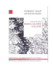
This explanatory booklet accompanies sheet n°4 (Bangalore-Salem) of the Forest Maps of South India published in 1992 by the French Institute of Pondicherry and which cover at the scale of 1:250,000, the south-eastern part of the Mysore plateau and the hills of the Eastern Ghats dominating the Tamil Nadu pediplain. It introduces the main concepts and methodology of this vegetation mapping exercise, as well as the particular bioclimatic features and forest successions that determine the patterns of vegetation in the part of the Western Ghats, which along with Sri Lanka constitutes one of the 34 world biodiversity hotspots. Each forest type is then described in terms of physiognomy, structure, floristic composition and diversity. Degradation and secondary stages as well as relationships between forest types are also presented. A complete list of species established for each forest type from an intensive fieldwork is also given, along with indications of species ecological preference, phenology, frequency, etc. Interpreted from satelite images, the vegetation maps show the actual state of the forests, their environmental conditions (climatic, edaphic, biotic, administrative) and their potentialities, according to standard codification used for international vegetation mapping.
Fichier principal
 Explanatory_Booklet_Hors_serie_21.pdf (3.36 Mo)
Télécharger le fichier
Map4_Bangalore_Salem.jpeg (7.27 Mo)
Télécharger le fichier
Explanatory_Booklet_Hors_serie_21.pdf (3.36 Mo)
Télécharger le fichier
Map4_Bangalore_Salem.jpeg (7.27 Mo)
Télécharger le fichier
Origine : Accord explicite pour ce dépôt
Format : Autre
Loading...