Veni, vidi, delineavi : Beirut cityscape in the late 18th century through Russian Navy maps - Archive ouverte HAL Accéder directement au contenu
Poster De Conférence Année : 2003

Veni, vidi, delineavi : Beirut cityscape in the late 18th century through Russian Navy maps

Veni, vidi, delineavi: le paysage urbain de Beyrouth au XVIIIe siècle d'après des cartes de la Marine russe

Résumé

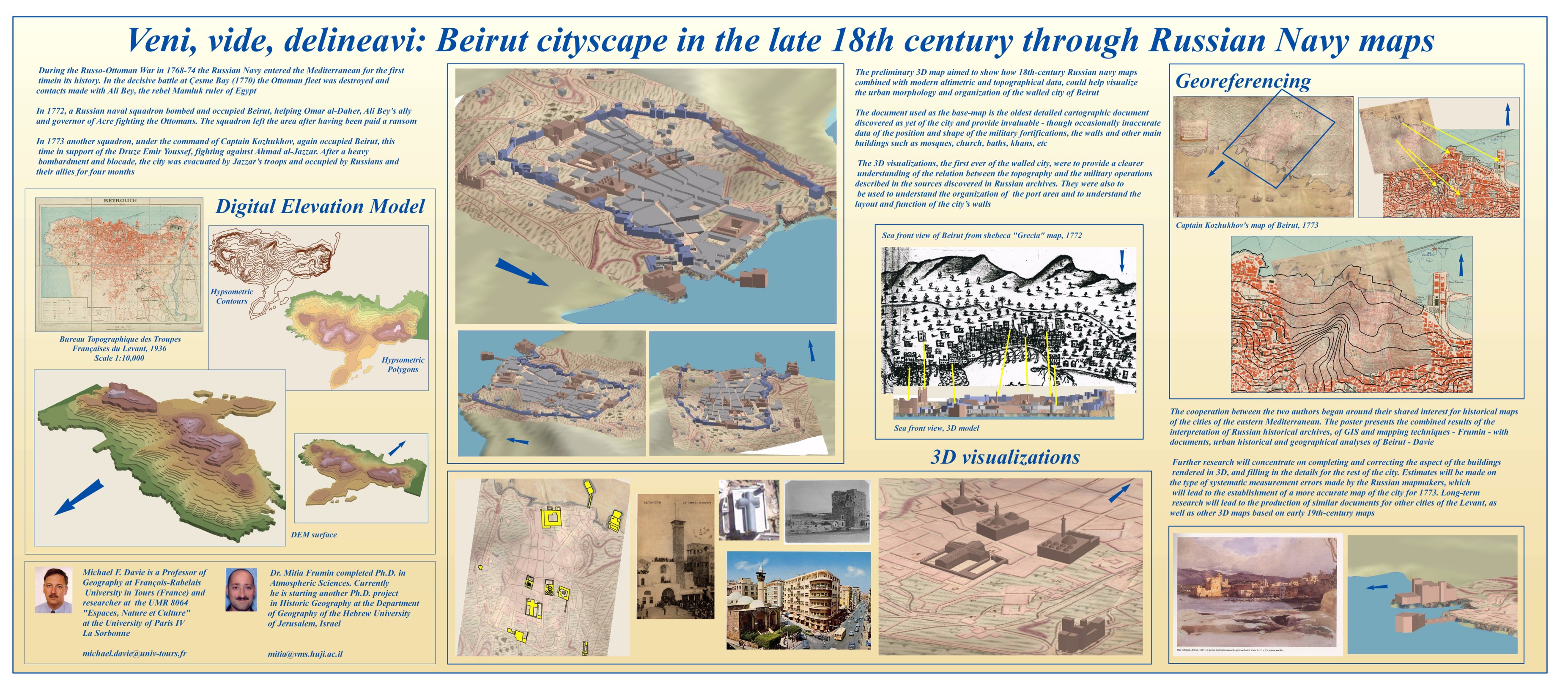
A 3D reconstruction of the intra muros city of Beirut (today's Lebanon) was produced through the analysis of Russian Navy maps drawn in 1773. The documents were projected on a DTM of the city, and the main buildings represented thanks to comparisons to contemporary paintings and drawings.
Vignette du fichier
Davie Frumin Beirut.jpg (1.53 Mo) Télécharger le fichier
Format : Figure, Image
Origine : Fichiers produits par l'(les) auteur(s)

Dates et versions

hal-01079407 , version 1 (14-11-2014)

Identifiants

  • HAL Id : hal-01079407 , version 1

Citer

Michael F. Davie, Mitia Frumin. Veni, vidi, delineavi : Beirut cityscape in the late 18th century through Russian Navy maps. 21ème Congrès international sur l'Histoire de la cartographie, Jul 2003, Budapest, Hungary. 2003. ⟨hal-01079407⟩
211 Consultations
12 Téléchargements

Partager

Gmail Facebook X LinkedIn More